Česká Obec Sokolská Case Study
About the project
Find out how the Google Maps Platform supports a Czech non-profit organization in popularizing sports for people of all ages. This gymnastics organization was established over 160 years ago based upon the principle of “a strong mind in a sound body”.
Industry: Non-Governmental Organization
Country: Czechia
Solution / Service: Google Maps Platform
Category: Professional Map Usage
Czech Sokol Community (Česká Obec Sokolská) is a Czech gymnastic association. Historically, it positioned itself as one of the largest and most successful gymnastic organizations. The founders are Miroslav Tyrš and Jindřich Fügner.
The history of Sokol
Since its foundation in 1862, Sokol’s mission has been to promote health and physical fitness. It has also played a vital role in cultural and historical events. Its history is closely linked to the Czech state’s history. The Parliament of the Czech Republic recognized the merits of Sokol’s members in the fight against criminal regimes (i.a., the Nazi regime). The Parliament declared the 8th of October the Memorial Day of Sokolism, a significant day for the Czech Republic. On this day, as a symbol of remembrance, anyone can pin a Sokol cockade to their chest.
Today, Sokol has more than 150,000 members and operates in over 1,000 villages and towns. The organization’s mission is upheld even by people forced to leave Czechoslovakia. They founded Sokol associations in several new homelands. Today they are present in 15 countries. Among the active countries, we can name France, Austria, Switzerland, the USA, and Australia.

2024 will mark 100 years since the first Czechoslovak Olympic gold. It was won by a Sokol – Bedřich Šupčík. He won in climbing during the 1924 summer games held in Paris.
Sokol in numbers
Google Maps Services at Sokol
Sokol uses Google Maps to visualize the location of the Sokol halls, sports fields, and offices. Google Maps also records the exact location of events organized by Sokol across the country. These include various runs, orienteering races for children, forest courage trails, and summer residential camps.
Each year, Sokol organizes over 5,000 events. If you want to become a member of Sokol and start practicing sports or get involved in the rich cultural activities of the association, all you need to do is find one of the gymnastic units closest to your location. Google Maps on the Sokol.eu website will help you do that.
You can also join the rehearsal of some of the songs for the upcoming XVII All-Sokol Meeting. You can find a list of them on the Sokol.eu website.
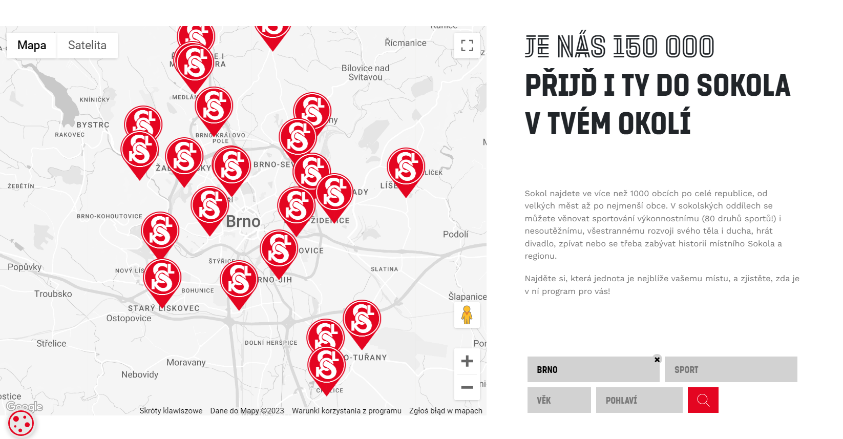
You can also search by sport and choose from 80 different sports disciplines – anything from aikido to sailing. The map will show you all the places that offer your chosen sport.
Use the map to get a quick overview of what sports are available in a given area.
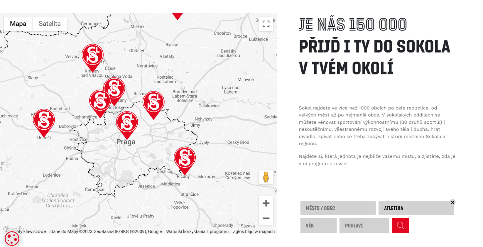
Sokol implemented a stylized version of the dynamic map. The map and colors aren’t the only customized elements. The markers/pins have also been stylized to match the Sokol website’s design.
Cooperation with Globema – results and benefits
Before the cooperation with Globema, Sokol (as a non-profit organization) used the services of a local agency to cover the costs of utilizing and implementing Google Maps services.
Sokol’s collaboration with Globema – a Google Premier Partner – began in February 2023.
Clustering for better visibility
After an initial analysis, Globema recommended using the clustering feature to improve the visibility of information displayed on the map. Currently, Sokol uses Google’s dynamic map to present all Sokol units in the country. Over 1,000 locations are displayed on the map.
Clustering makes the information presented on the map clearer. This feature groups markers in close proximity on the map when the user zooms in.

Clustering makes the map display clearer. When you zoom in, adjacent sites are shown as a number marker – indicating the number of sites marked on the map in that area.
Globema’s specialists proved to be very helpful – they recommended changes that will make our website more user-friendly. Visitors to our website can find the information they are looking for faster. Working with Globema – a premiere Google partner – has also enabled us to significantly reduce the cost of using Google Maps. Cooperating with Globema is very pleasant, rational, and fast. We highly recommend it to any undecided.
Mr. Jiří Reichl – Communications Manager and Spokesperson, Česká Obec Sokolská