Learn how QADRA PLUS developed its GPS monitoring system using Google Maps
Project background
According to Slovak law, transport, logistics, and other companies are required to track the routes of their fleet for accounting purposes. Without tracked routes and addresses of the visited places, companies cannot list costs related to their vehicle usage (fuel, depreciation, car repairs, etc.) in accounting and therefore benefit from tax deductions.
These routes and related costs can be calculated in two ways. The first one requires keeping a physical logbook for every car (and filling it in using the traditional pen and paper). This method however generates a lot of additional tasks in the accounting process. The second is a modern way of route (and cost) tracking – using GPS tracking services. This is what QADRA PLUS provides to its customers in Slovakia and beyond.
Contents:
Industry: GPS Tracking
Country: Slovakia
Solution / Service: Google Maps Platform
Category: Transport and logistics
QADRA PLUS has been in the GPS monitoring market since 1998. Back then, as QADRA, they developed the first offline GPS logger with record storage on a removable CompactFlash memory card. Currently, QADRA PLUS provides GPS/GPRS monitoring of cars and trucks, public transport vehicles, machinery, as well as working and agronomic machines. The company started to use Google Maps in 2007. The cooperation with Globema began ten years later, in 2017.
About QADRA PLUS’s solutions
QADRA PLUS’s approach in the early days
Before solutions such as Google Maps and common access to the Internet, to track vehicle routes, it had to be equipped with a physical GPS tracking device. At the end of each day, the data from such a device had to be physically downloaded to a computer. This data was provided in the form of geographical coordinates which, in order to serve its purpose and be useful to the end users, had to be further processed to return locations in the form of addresses (reverse geocoding).
To carry out this process, QADRA PLUS had to use a geocoding database of all existing addresses in Slovakia. The company had to purchase the entire database, despite the fact that for the purpose of conducting their business, they only needed selected addresses.
Later, with the advancement of technology, QADRA PLUS didn’t have to physically download the contents of every GPS tracking device as this was done automatically online. Yet the downloaded data still had to be processed using the geocoding database in order to convert coordinates into addresses.
“We are a family business. I took over the management of the company as well as the development and design of new hardware and software from my father in 2018, 20 years after it was established (1998). My father has been working with electronics since before the velvet revolution in 1989. Today he still cooperates with us and mainly draws printed circuit boards (PCBs) for new hardware, but he’s not dealing with its features – it’s my role now. At his age of 73, he supports our approximately 350 customers with invoicing and our company with business administration.”
QADRA PLUS’s GPS tracking solution
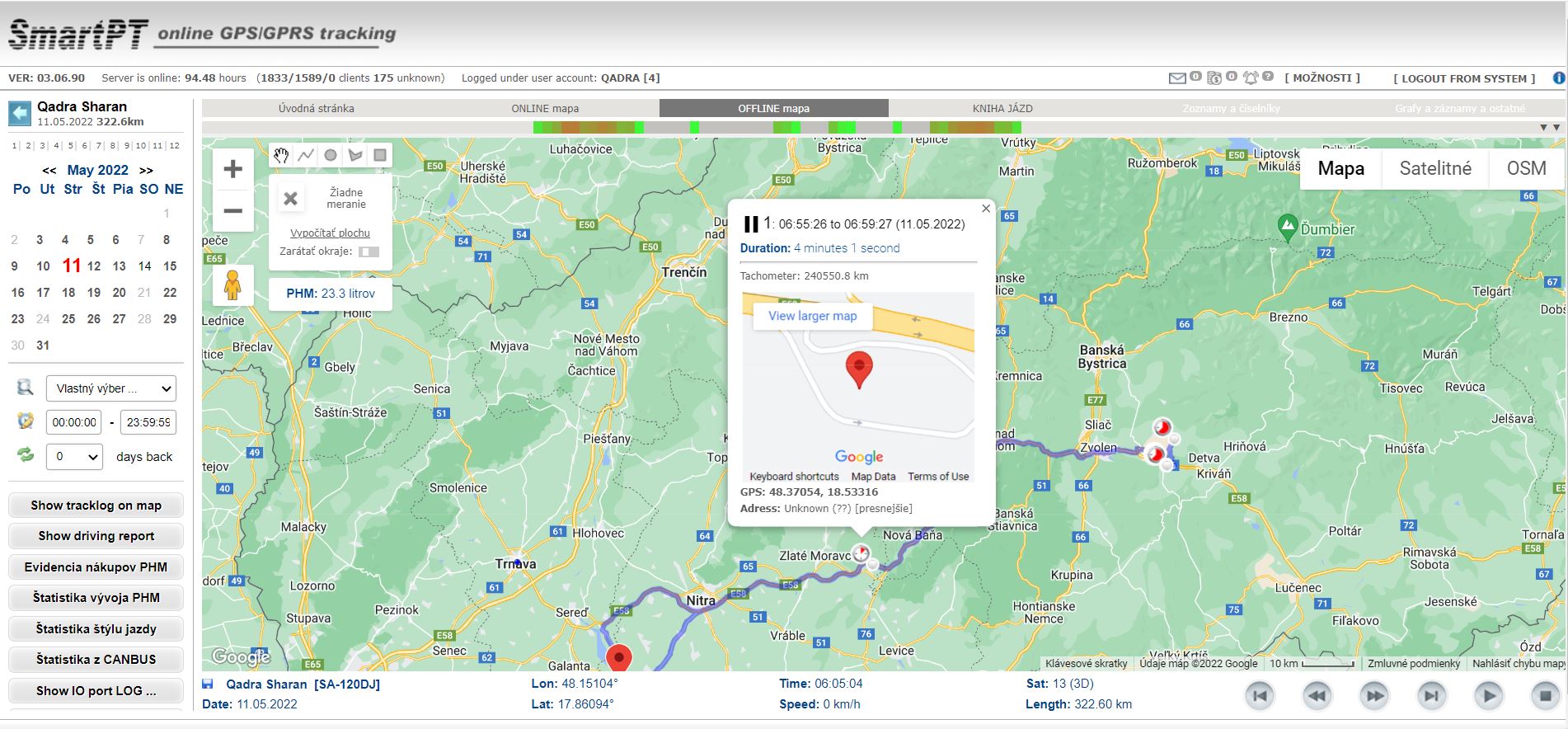
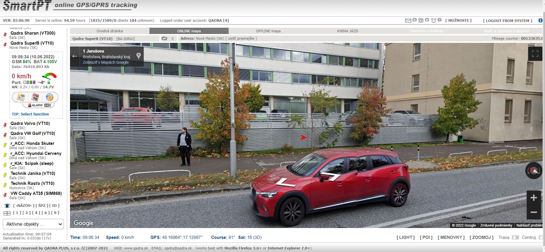
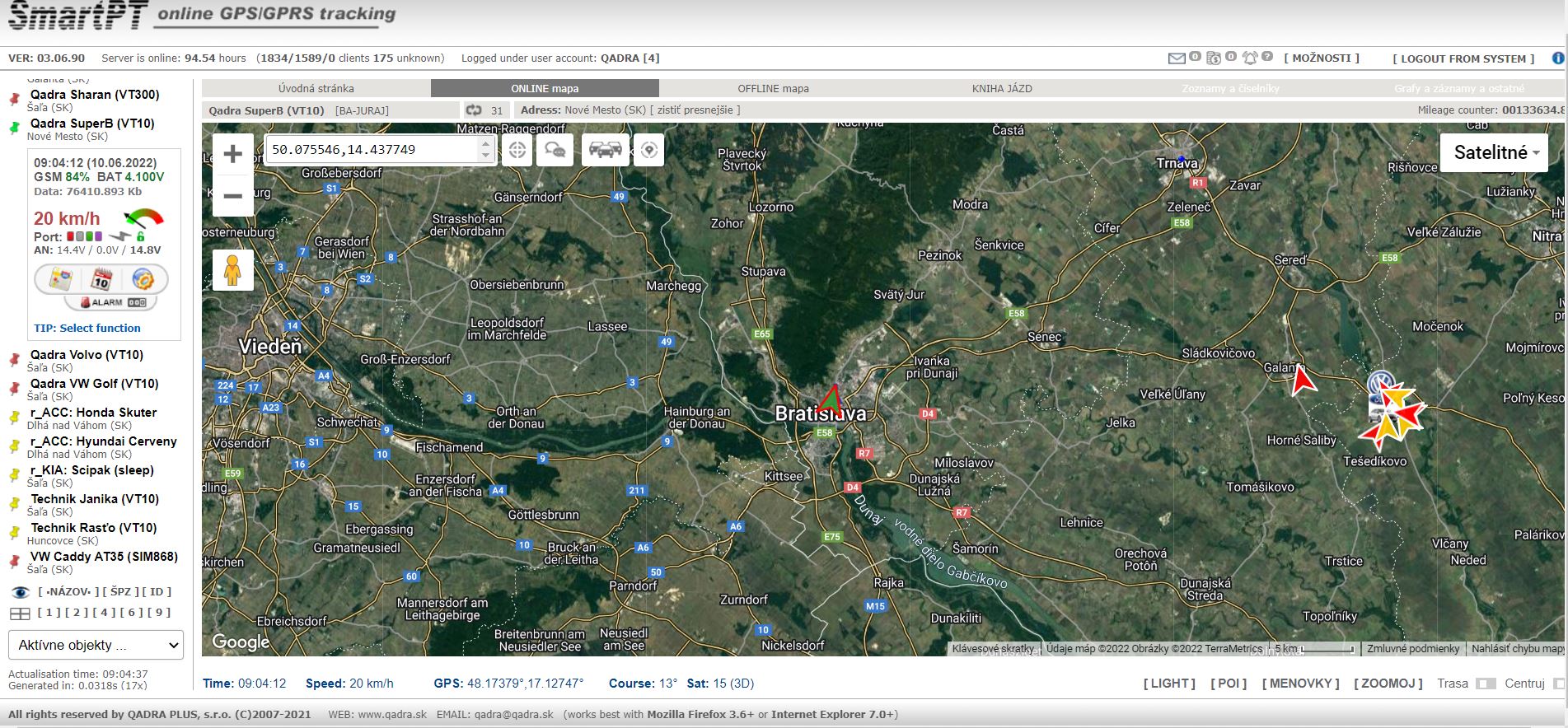
QADRA PLUS’s latest GPS tracking solution consists of a physical device collecting the GPS data, a web application for desktops, and a progressive web application for mobile devices. The applications give access to all the information about the routes of the vehicles: the itinerary, mileage, timing, locations and time of breaks, etc. – all displayed in a logbook and on a map.
Some of the application features include:
Click to zoom
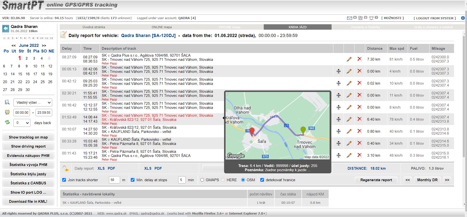
A route address inventory – a logbook of visited addresses with a preview of the locations shown on a static map.
Click to zoom
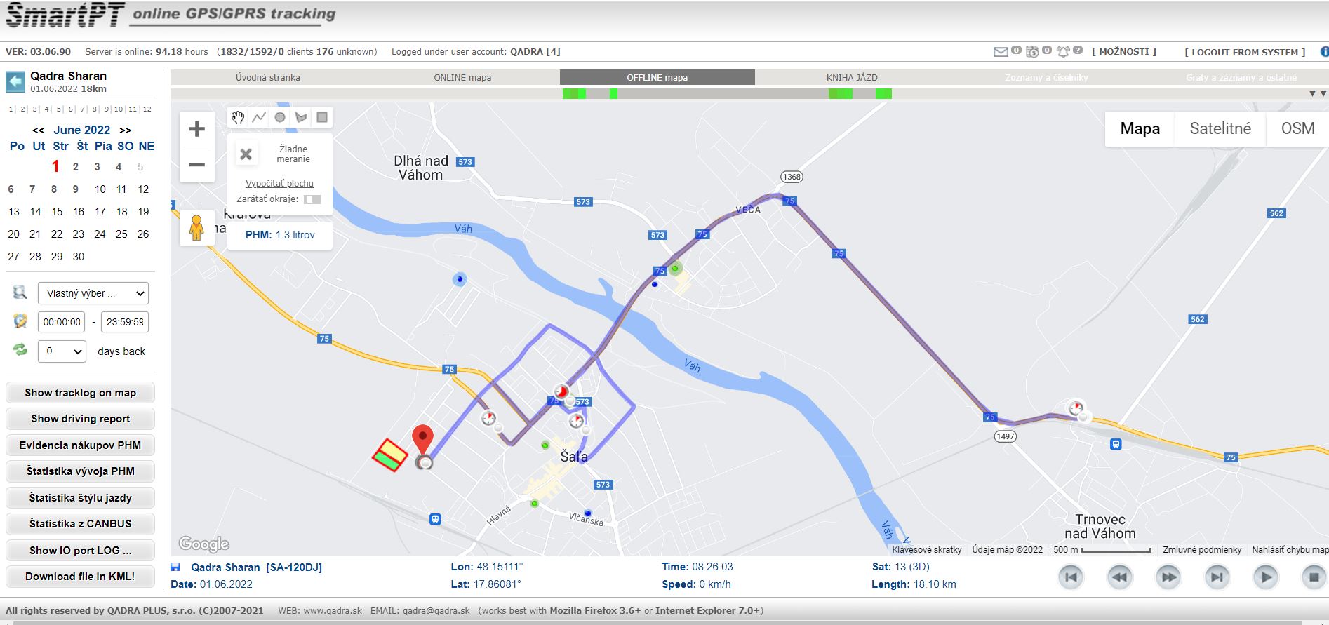
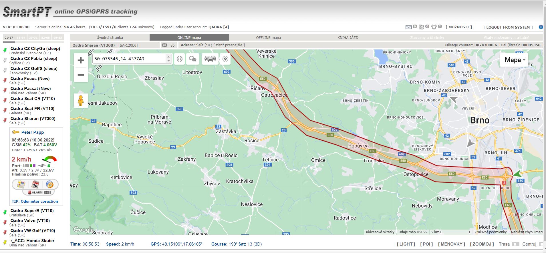
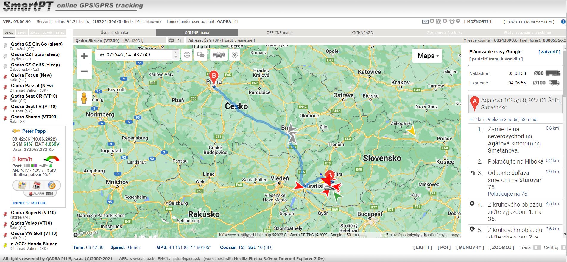
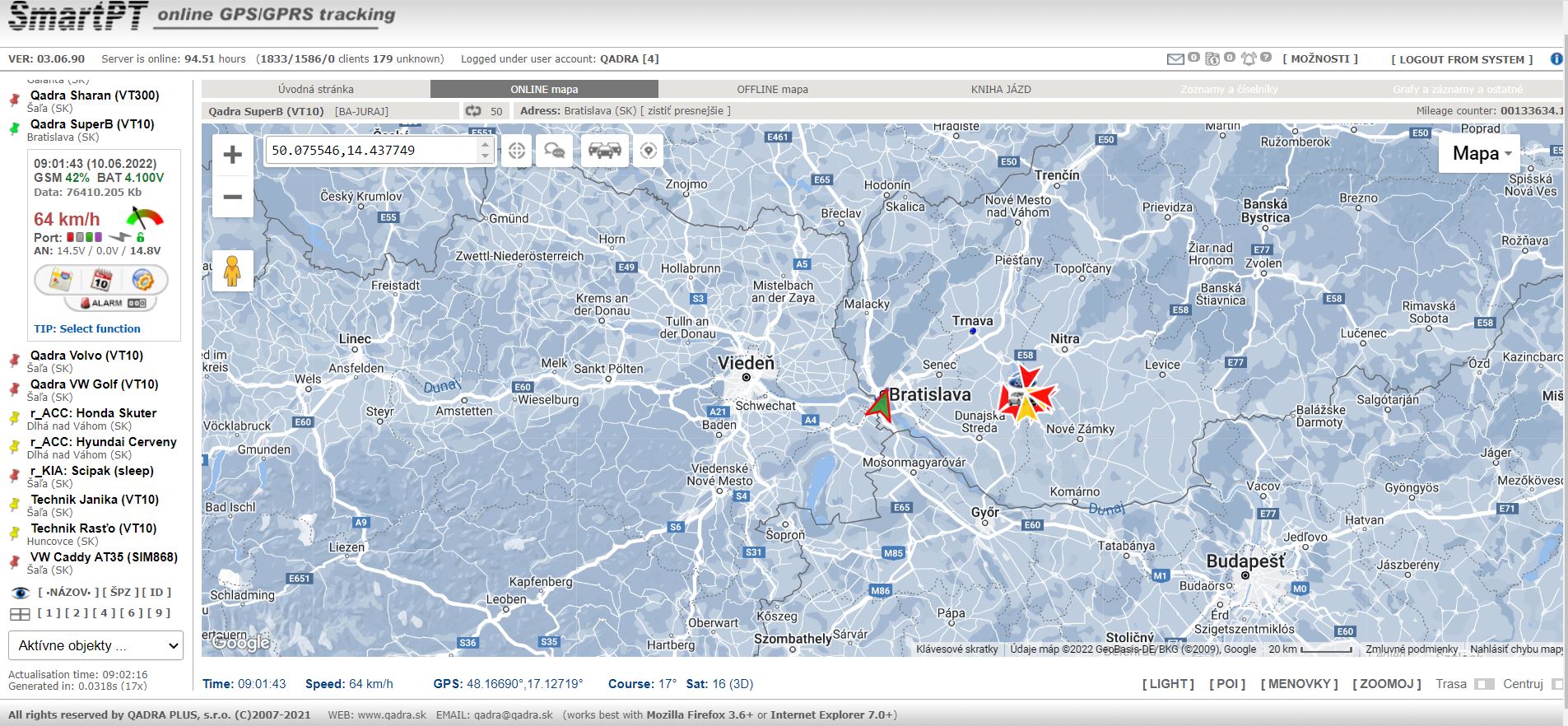
Visualizing the real-time vehicle locations.
Qadra Plus’s GPS tracking system – view of the application
Challenge
For QADRA PLUS’s customers to be able to fully utilize the potential of QADRA PLUS’s GPS tracking solution, the company needed to integrate it with map services that provide the necessary data, allow conversion of coordinates into addresses, and visualize data processing results (that is, show the effects of GPS tracking on a map).
Solution
All of this is provided by Google Maps which enable reverse geocoding – the process of converting geographic coordinates into a named location (e.g. address). This is essential for QADRA PLUS’s business, as the core feature of the company’s GPS tracking solution is route address inventory, where geocoding plays a major role.
Also, Google Maps allows the visualization of data processing results (the itinerary of every vehicle is shown on the map) to give QADRA PLUS’s users the ability to track patterns and routes followed by their fleets.
The company uses several Google Maps APIs:
- Dynamic Maps (Maps JavaScript API) – visualizes fleet location in the real time as well as historical routes recorded via GPS monitoring devices
- Geocoding API – a logbook (route address inventory)
- Directions API – used for route planning and assessing the estimated time of arrival (ETA)
- Static Maps API – shows a location preview in the logbook
Effects
The main advantage of Google Maps for QADRA PLUS (both now and when the company only started using Google Maps), is data availability. They don’t have to purchase a whole package of addresses anymore to use a geocoding database of addresses. This is very affordable for smaller companies. Thanks to the Google Maps model, QADRA PLUS has a chance of working with maps and map services legally.
Moreover, when Quadra started using Google Maps, they were available for free, and, compared to other free databases (like OSM), as well as the paid ones, they offer much higher data quality.
Thanks to Google Maps, QADRA PLUS’s customers have easy access to precise information on their fleet provided in real time.
Benefits of using Google Maps in numbers
5000
tracked vehicles
4
of data visualized per month
36
of location data points
3
growth in the number of vehicles using QADRA PLUS's services in 6 years
What QADRA PLUS says about us:
“We are very satisfied with Globema as our Google Maps partner, because of their responsivity and the possibility of receiving support in Slovak. We appreciate partner invoicing and pricing, as well as access to the latest news about new product and service releases”.
