
Recently, Google released new exciting features for those implementing Google Maps on their websites and in applications. Read on to learn about Photorealistic 3D Tiles, 2D Tiles, and Street View Tiles, and how you can use the new Map Tiles API to craft immersive maps at scale!
Photorealistic 3D Tiles
Since their experimental launch, Photorealistic 3D Tiles have revolutionized map experiences across various industries. Here are some examples of how developers leverage these tiles:
Let’s explore specific applications in various industries!
Real Estate and Urban Planning
BNP Paribas Real Estate employs Photorealistic 3D Tiles to visualize today’s and tomorrow’s cities across Europe. Merging proprietary and public open data, the solution provides urban planners, investors, and commercial real estate customers with a comprehensive view. It displays 3D cityscapes overlaid with property market data and local points of interest, offering insights into potential city changes based on forecasts.
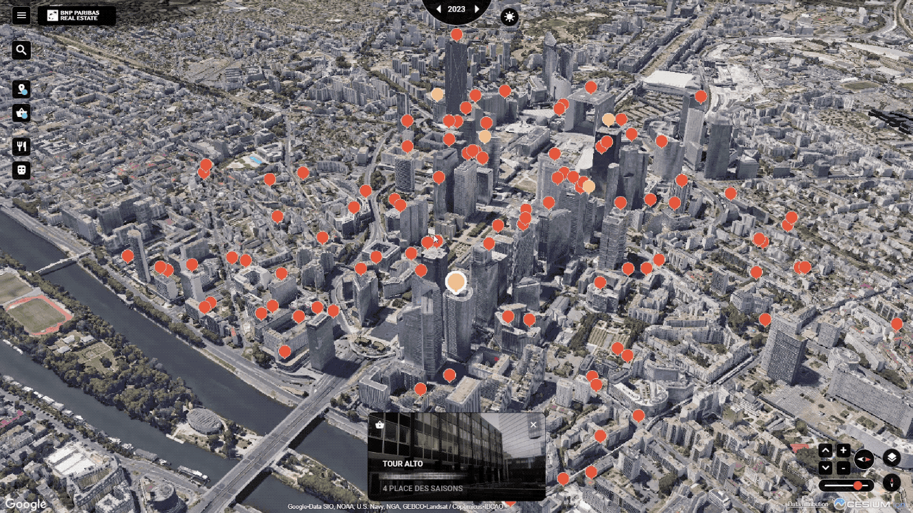
A 3D visualization of Paris, presenting how the real estate market and city infrastructure may change in the future
Tourism, Gaming Industry, and others
Alberto Taiuti, an augmented reality expert, built a real-time guided tour editor of Florence, Italy, using Photorealistic 3D Tiles. His demo illustrates a practical application where users can drop pins on popular locations, guiding others in real-time through augmented reality. The multiplayer map experience has potential applications in gaming, tourism, and community development projects.

Architectural Design
Geopogo, a software company specializing in location-based AR tools for architectural and urban design workflows, integrates Photorealistic 3D Tiles into their Magic Leap 2 AR glasses. Serving as an AR occlusion layer, the Tiles enable architects and developers to visualize 3D models in the context of real-world environments. This feature facilitates designing, reviewing, and showcasing building models in immersive visualizations, offering a practical alternative to traditional artistic renderings.

2D Map Tiles and Street View Tiles
For developers working in non-Javascript environments, 2D Map Tiles provide access to roadmap, terrain, and satellite imagery, while Street View Tiles offer panoramic images with enhanced metadata for customized Street View experiences.
Interested in incorporating these features into your projects? Reach out to our experts to explore how Google Maps products can support your business goals.
Source: https://cloud.google.com/blog/products/maps-platform/build-immersive-maps-at-scale-with-photorealistic-3d-2d-and-street-view-tiles-now-in-ga